The GPS map shows where taxi vehicles are right now, who is driving them, and whether anyone is speeding — without calling the driver. It requires linking a GPS tracker to a specific vehicle in the panel. This guide covers adding the device to a vehicle, reading the summary tiles, and checking the details of a selected vehicle on the map.
Link a vehicle to the GPS map
- Open Vehicles, pick a car and open its edit form.
- In IMEI number / GPS ID, enter the identifier sent by the GPS tracker installed in the car.
- Save with Save changes and open Map in the menu.
Summary tiles and the Fleet list
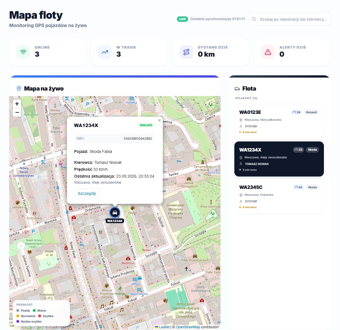
Above the map, four tiles summarize the current state of the fleet: Online (vehicles with a signal from the last 15 minutes), On trip (vehicles currently moving faster than 3 km/h), Distance today and Alerts today. To the right of the map, the Fleet card lists every GPS vehicle; the search box above the map filters it by registration number or driver name. Positions refresh every 5 seconds, and the LIVE badge next to Last sync confirms the data is not stale.
Speed legend and vehicle details
Marker and route color encode speed: grey for stopped, yellow for slow (up to 40 km/h), orange for normal (41–80 km/h), red for fast (81–110 km/h), and dark red for very fast (above 110 km/h); a legend in the bottom-left corner of the map explains the colors. After selecting a vehicle, its details card shows speed, heading, the assigned driver, the last update time and an address, plus an Open vehicle profile button leading to the full vehicle view. Clicking the marker itself also opens a short preview with the IMEI number, vehicle name, driver and last update time — a quicker shortcut than opening the full details card.
In their own app, a driver sees a simplified version of the same map, limited to their assigned vehicle — they have no visibility into the rest of the fleet or its positions.
When the fleet has no GPS yet
Until at least one vehicle has an IMEI number, the map shows No vehicles with GPS instead of markers, along with a hint to add the IMEI in vehicle editing. Below it, the History, Reports, Alerts and Zones tabs let you analyze routes and speeding once vehicles start reporting a position.