Speed zones let you set a custom limit for a chosen area — a depot, a parking lot, a city centre — independent of OpenStreetMap road limits. The Alerts tab shows who exceeded the applicable limit and where. This guide covers drawing a zone, setting the tolerance, and reviewing the alert history.
Draw a speed zone
- On the Map, open the Zones tab and click New zone (polygon) or New zone (circle).
- Click on the map to add polygon vertices (at least 3), or set the circle's centre and adjust the Radius with the slider.
- Enter a zone name, a limit in km/h, and pick a Zone colour.
- Save with Save zone.
Drawing a polygon needs at least three points, and the Undo point button removes the last vertex if you make a mistake. For a circle, you set the radius with a slider from 50 to 5000 m, or type an exact value up to 50,000 m, and a zone's speed limit ranges from 5 to 140 km/h.
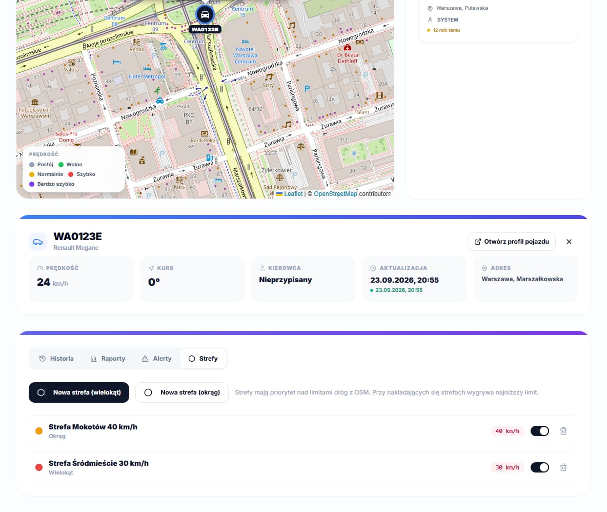
Limit priority: zone, OSM roads, global limit
When a vehicle is inside more than one active zone, the lowest of their limits applies. A zone always takes priority over a road limit fetched from OpenStreetMap; only when a vehicle is outside every zone does the system check the road limit, and only after that does it fall back to the fleet's global limit from Maximum speed (km/h) under Settings → General (125 km/h by default).
The zone limit and the OSM road limit both get a Speeding tolerance (km/h) added on top, set in the same place (10 by default, range 0–30) — a margin for GPS noise. The global limit gets no tolerance: an alert is raised as soon as it is exceeded.
Speeding alerts
The Alerts tab shows a table with Type, Vehicle, Driver, Date and Speed columns; the type is the zone's name, "Road limit" for an OSM-based limit, or "Fleet limit" for the global one, and the speed column also shows the limit that applied. The same vehicle cannot raise another alert more than once every 5 minutes, so the list is not flooded with repeats from one long stretch of speeding.
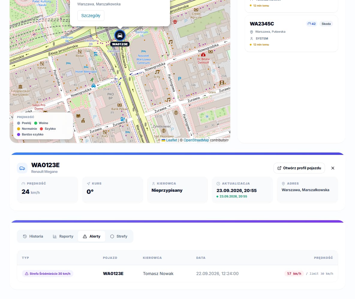
Deleting zones and an empty list
Deleting a zone with the trash icon requires confirmation in a dialog asking whether you really want to delete the zone by that name — the action cannot be undone. Until at least one zone has been drawn, the list shows No defined zones with a hint to draw the first one, for example for a depot or a city centre. Before a zone can raise alerts for a given vehicle, make sure that vehicle already has an IMEI number configured — without a GPS signal, the system has no way of knowing whether the car is inside its boundaries at all.